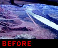
 During the 1950s, the drainage around the Green River in Utah became the center of the universe for the burgeoning uranium industry. Scores of dedicated geologists and wishful prospectors alike scoured the river's carved sandstone cliffs with Geiger counters and miner's picks looking for the yellow or gray powder that would power the worlds nuclear plants and provide the raw material for powerful weapons of destruction. Larger companies hired small aircraft to fly up and down the river gorge with scintillator-armed scientists looking for signs of the radioactive mineral. During the 1950s, the drainage around the Green River in Utah became the center of the universe for the burgeoning uranium industry. Scores of dedicated geologists and wishful prospectors alike scoured the river's carved sandstone cliffs with Geiger counters and miner's picks looking for the yellow or gray powder that would power the worlds nuclear plants and provide the raw material for powerful weapons of destruction. Larger companies hired small aircraft to fly up and down the river gorge with scintillator-armed scientists looking for signs of the radioactive mineral.
Unfortunately for the scientists, the terrain sculpted by the river created a bold and forbidding landscape which proved frustratingly difficult to navigate except by river raft or pack mule. As promising sites were identified, the arduous task of cutting dirt roads and bringing in heavy excavating machinery to begin the mining process commenced. To aid in the logistical support and to ferry executives back and forth to the mine sites, runways were carved out of the rugged landscape.
Toward the end of the 1960s and early 1970s, a growing and vocal environmental movement raised sufficient concerns over the safety of the nuclear power industry to effectively cripple the technology that once held the promise of almost limitless power for generations to come. With its end came the demise of the Utah uranium industry as well. Soon all the mines were closed and the equipment was removed or abandoned.
Approximately 25 miles west of Moab, Utah, on the Green River lies Mineral Canyon, site of a small uranium mine opened by the Excalibur Mining Co. in the very early 50s. Associated with this mine is an airstrip traditionally called Mineral Bottom. When the ore deposit at the Excalibur mine failed to remain profitable, the airstrip fell into disrepair, and today only a few pieces of rusting mining equipment stand in mute testimony to the once bustling enterprise. Over the years, a few charter companies have occasionally flown clients into or out of the strip in support of the river rafting businesses which flourish to this day.
The land that encompasses Mineral Canyon and the Mineral Bottom airstrip is administered by the Bureau of Land Management (BLM), which has the jurisdiction over its use and development. When cataloged by the Utah Back Country Pilots Association as part of our survey of Utah airstrips, the runway was still usable but quite rough, with weeds and bushes endeavoring relentlessly to reclaim the land. The beauty and solitude of Mineral Canyon made this strip one of the first on our priority list.
Enter Paul Swanstrom. Paul operates a one-man flying service, using a Cessna 185 on skis in Alaska in the summer and ferrying hikers and sight-seers out of the Moab area of southeastern Utah in the winter. Paul was instrumental in initiating the paperwork required for the BLM to issue a “right-of-way” for the airstrip. This would allow Paul to use the strip commercially and would permit the public to use it non-commercially. (For a reasonable fee, Paul will deliver non-aviators and their gear to and from Mineral Canyon. Paul's operation is first class and we highly recommend him.)
The BLM was cooperative and friendly. However, a government agency is still a government agency, and as such has a list of rules and policies for just about everything—back country airstrips included. First on the list was the launch of an Environmental Assessment study. This study, while time consuming, ultimately came out in favor of “legitimizing” the strip, with the report supporting the need for certain improvements. There were a few other hurdles to clear before work could begin, but we were confident we would soon be landing on a smooth and firm dirt strip.
We were wrong. As our efforts wound their way through the regulatory process, a well funded environmental group sought to block the whole project. They wanted to have had the strip annihilated and the land returned to river mud and weeds. The red flag they raised was concern for the protection of a Peregrine Falcon aerie located on the cliffs overlooking the river. According to BLM biologists, the aerie had been abandoned for at least five years, but the objection raised by the group was sufficient to stop the whole project dead in its tracks. The EPA came to our rescue by removing the Peregrine Falcon from the Protected Species list of the Endangered Species Act. This removed the only viable objection to our endeavor, and the project moved forward.
Finally, in the fall of 1998, everything was in order. The permits were issued, and the strip was graded and cleaned up by the County Road Crew. (There is a road into Mineral Canyon forming part of the very popular “White Rim Trail” which traverses through Canyonlands. The dozen or so switchbacks descending into the canyon are spectacular and not for the faint of heart!)
Our excitement at the prospect of enhanced use of the strip was tempered once again as an unusually wet spring and early summer kept the freshly graded strip under water. Finally, late in the summer the ground dried up and the strip was left in great shape: nicely packed down and firm.
 
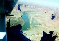
The Mineral Bottom Airstrip sits in the bottom of a 500' deep river gorge. While a little narrow and somewhat intimidating to the first time visitor, it is actually easier and safer than first impressions would seem. The gorge maintains a fairly constant width with no excessively sharp bends and is easily navigable if you keep the speed down. There are no hazards or restrictions such as towers or power lines strung across the canyon anywhere near the strip. A flight down the canyon within the canyon walls is possible for a good number of miles—though I can't speak for the whole length, because I haven't taken the time to go that far.
The best approach—and really the only one for new pilots—is the downstream landing. The strip can be landed upon from either direction, but a go around upstream would have a plane flying uphill while trying to climb out of the canyon. Going around for a down-river approach is simply a matter of following the river until you have gained enough altitude or the river has dropped away enough to escape the canyon walls.
Before accessing the strip, a few words on being a good neighbor are in order. The airstrip is only a few miles north of the Canyonlands National Park Boundary. The park recommends pilots maintain 2,000 feet AGL within the park. Light airplanes are not particularly popular in this country. Resist the temptation to buzz low down the river. Please be courteous and stay away from the park if possible. Approach the strip from the north and depart toward the north if conditions permit. This is not a place for touch-and-go training.
Start the approach by flying a left-hand downwind leg above the rim of the canyon while memorizing the few bends in the river. Extend the downwind for perhaps two miles upstream. Slow down and configure early, then drop down between the walls and enjoy the view while flying downstream to the strip. Be sure to have your plane in final configuration, with the possible exception of that final notch of flaps. As you come around that last bend with a gentle left turn you should be right on top of the strip and perfectly aligned for a nice touchdown on the approximately 2,000 feet of firm, usable runway. If you are too high or too fast simply turn right and follow the river downstream until you can get out of the canyon, and then try again!

A visit to Mineral Bottoms provides a gorgeous panorama of high sandstone cliffs and the accompanying serenity and tranquility that comes with the territory. A camera is a must, as every view from any direction is like a poster. With a good telephoto lens, you can get a picture that will amaze your friends back home. From the north end of the strip, a view down the runway ends with a sheer sandstone wall that looks as if it blocks the departure end. Actually a simple right turn after lift off gives plenty of clearance, but the picture tells a different story. If you are a creative sort, an impressive “There I was.....” story can be had using the picture as proof.
Activities at the strip can include a visit to the abandoned Excalibur mine. It lies just upstream and is only a few hundred yards from the runway. This small area could comprise an entire course in the Colorado Plateau geology. The “channel sands” of the Chinle Formation are beautifully exposed here. It was these ancient buried stream channels that concentrated the uranium deposits and first drew prospectors to this area. If you require a more vigorous hike, Mineral Canyon winds off to the east with plenty of terrain to explore. This is also a mountain biker's paradise.
Mineral Canyon is approximately 25 air miles west of Moab. The strip has recently been added to the Denver Sectional and GPS users can plug in 38°32.5'N, and 10°59.5'W. The Sectional Chart shows the strip as private, but this only applies to commercial operations. It is open to the general public. The elevation is 3,900 feet and the strip is 2,100 feet long. There is a restricted area east of the strip, but it has been unused for many years. This was a rocket test area originally used for test firings back in the days of Nike and BOMARC missiles. A quick call to Cedar City Flight Service will give you an up-to-date status report for the area.
Though the strip looks imposing, almost every type of general aviation airplane is capable of safely going in and out of Mineral Bottom. As always, when flying into and out of rugged, undeveloped strips good prudence must rule. Strong or gusty winds should probably provoke a diversion to Moab, where you can sample Southern Utah beauty from the ground. Most days though—especially during the winter and spring—Mineral Canyon and the Mineral Bottom airstrip should provide a truly unique experience for the adventurous pilot.
|

